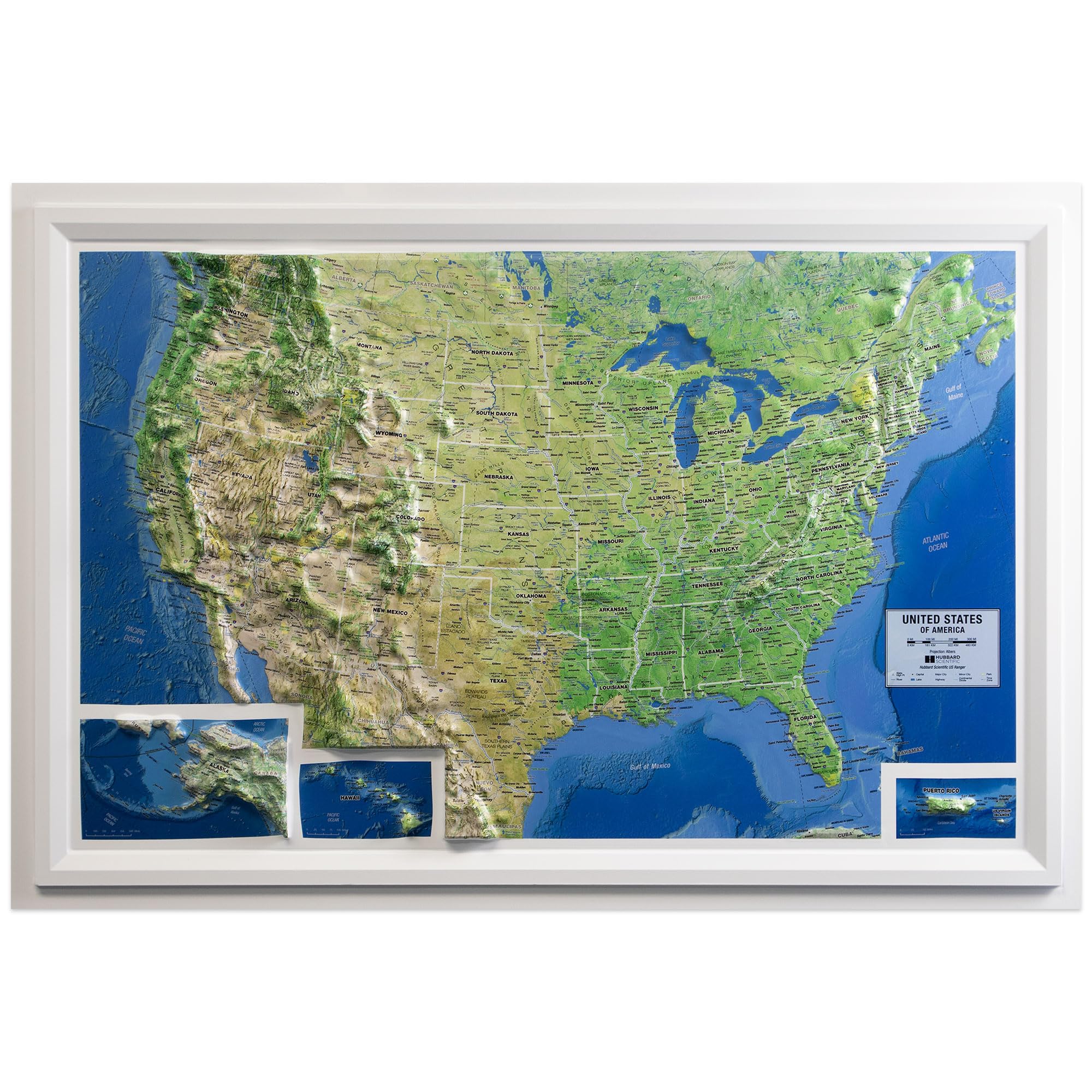
Hubbard Scientific United States Classic Raised Relief | A True 3D Map You Can Feel the Terrain | Vaccum-formed Molded Map | 36'' x 24'' | Detailed Topography
Swiftmaps Europe Wall Map GeoPolitical Edition SM EUR SM L
HUBBARD SCIENTIFICHUBBARD SCIENTIFIC AMERICAN EDUCATIONAL PROD 432 - United States Relief Map - United States Relief Map - Each
Gall Orthographic World Map | Most Accurate World Map - Countries are Shown in Correct Proportion to Each Other | Laminated World Map | 36” x 24”
Raised Relief 3D Map of Israel (MEDIUM: 14.5 x 6.5)
2 Pack - Laminated World Map Poster & USA Map Set - Equal Earth world map design shows continents at true relative size - US Map 18” x 29”
World Ranger 3D Map by Hubbard Scientific | A True Raised Relief Map - You Can Feel the Terrain | Vacuum-formed Molded Map | 36'' x 24'' | Detailed Topography
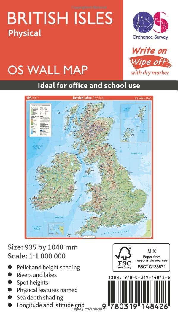
Wall British Isles Physical (OS Wall Map)
Ireland Geological Map - 3D effect relief Print, Ireland Relief Map, Ireland Topo Map, Dublin, Limerick, Ulster, Connaught, Munster,Leinster (180gsm Matt, 32 x 24 IN)
DAYONG Scratch Off Word Map, Scratch Off Map with Scratcher and Brush, 82x60CM Scratch Off Travel Poster, Travel Map Wall Art Gift for Outdoor Enthusiasts
Alps relief wall map Georelief: Reliefkarte
Middle East, Tubed: Wall Maps Countries & Regions
United States Classic Raised Relief | A True 3D Map by Hubbard Scientific - You Can Feel the Terrain | Vaccum-formed Molded Map | 36'' x 24'' | Detailed Topography
Scratch Off Map of United States, 12x17 inch Travel Map, United States Map for Traveling with 25 Unique Accessories, Colorful Scratch Map, Travel Map Scratch Off, Gift for Travelers
Swiftmaps Africa Wall Map - GeoPolitical
Hubbard Scientific 3D United States Map | A True Raised Relief Map - You Can Feel the Terrain | Vacuum-formed Molded Map | 34.5″ x 22″ | Detailed Topography
North Circumpolar Region Wall Map - Bilingual - Atlas of Canada - 43" x 36.5" Paper
RMC 32" x 50" Classic United States USA and World Wall Map Set (Classic Edition)
British Islands Geological Map - 3D effect relief Print (2D map with 3D effect using satellite terrain data) (200gsm SATIN, 32 x 24 IN)
MOVA Globe Blue Relief Map 4.5"
Raised Relief 3D Map of Israel in Jesus' Time (Shows Place Names Under Roman Rule) Map – Wall Map, 1 Jan. 2016
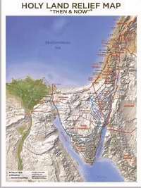
Chart - Holy Land Relief Map Wall (Laminated)
CARTE EN RELIEF DE LA HAUTE SAVOIE VERSION ETE Paperback – 15 Feb. 2017
Hubbard Scientific 3D Great Smoky Mountains 403 Map | A True Raised Relief Map - You Can Feel the Terrain | Vacuum-formed Molded Map | 18.5″ x 12.5″ | Detailed Topography
Hubbard Scientific 3D Cumberland NJ173 Map | A True Raised Relief Map - You Can Feel the Terrain | Vacuum-formed Molded Map | 31″ x 20.5″ | Detailed Topography
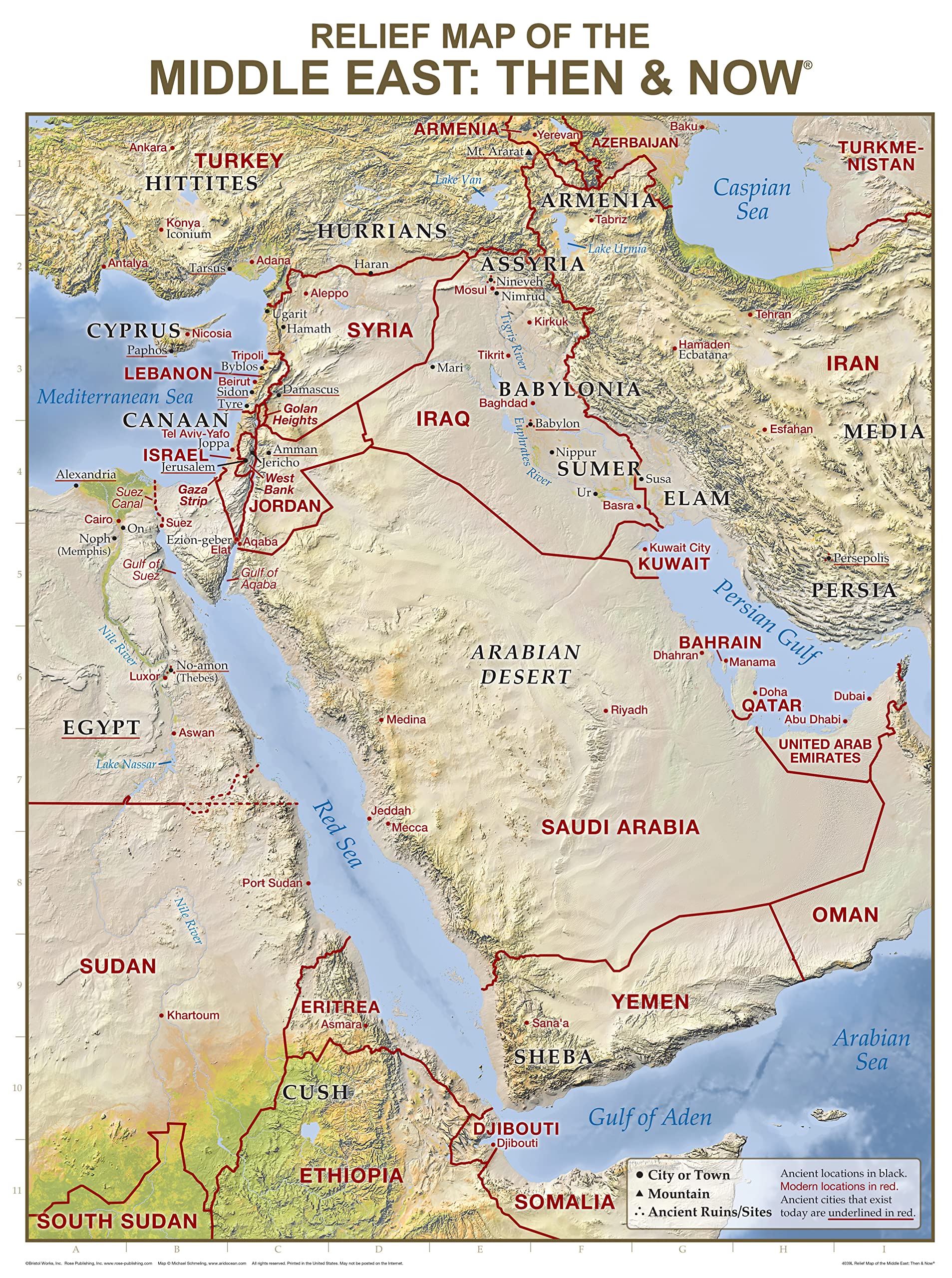
Relief Map of the Middle East: Then and Now Wall Chart (Charts)
Relief Map of the Holy Land: Then and Now Wall Chart (Charts)
Hubbard Scientific 3D New Mexico NM1720 Map | A True Raised Relief Map - You Can Feel the Terrain | Vacuum-formed Molded Map | 17” x 20” | Detailed Topography
Historic Pictoric Wall Map, World - Ocean Floors and Land Relief. 1976 - Vintage Wall Art - 36in x 24in
Hubbard Scientific 3D San Francisco Bay SF2225 Map | A True Raised Relief Map - You Can Feel the Terrain | Vacuum-formed Molded Map | 22” x 25” | Detailed Topography
United States Ranger 3D Map by Hubbard Scientific | A True Raised Relief Map - You Can Feel the Terrain | Vacuum-formed Molded Map | 36'' x 24'' | Detailed Topography
Hubbard Scientific 3D Arizona 961 Map | A True Raised Relief Map - You Can Feel the Terrain | Vacuum-formed Molded Map | 24" x 30.5" | Detailed Topography
Restoration Cartographic Greece Minimalist Relief Map, Topographic Wall Art for the Home or Office, Minimalist Series, 12 x 18 Inches
Holy Land New Testament Then and Now Relief Map (Charts)
National Geographic: United States, The Physical Landscape 1996 - Historic Wall Map Series - 31.25 x 20.5 inches - Paper Rolled
Hubbard Scientific 3D Knoxville NI171 Map | A True Raised Relief Map - You Can Feel the Terrain | Vacuum-formed Molded Map | 32″ x 20.5″ | Detailed Topography
Muir Way - Idaho 1909 Shaded Relief Map - Flat 2D Paper Print - Shaded 3D Illusion - Gallery Quality Fine Art Paper & Inks - 100% Cotton & Acid-Free - Made in USA - 24” x 36” 2D Print - No Frame
Raised Relief 3D Map of Israel in Jesus' Time (Shows Place Names Under Roman Rule)
Restoration Cartographic Colorado Restored Vintage Relief Map, Topographic Wall Art for the Home or Office, American States Series, 12 x 18 Inches
Hubbard Scientific 3D Yellowstone 419 Map | A True Raised Relief Map - You Can Feel the Terrain | Vacuum-formed Molded Map | 18.5″ x 25″ | Detailed Topography
Updated Torres del Paine National Park Complete Topographic Map Atlas 1:50000 (1cm = 500m): Travel without a Guide in Chile Patagonia. Trekking, ... (Travel Without a Guide Hiking Topo Maps)
Laminated World Ranger Map Poster | Physical Style Map | Includes The Most Legible Location Labels | 36” x 24” | Shipped Rolled in a Tube, Not Folded | Great for The Home, Office, or Classroom...
National Geographic New Zealand Wall Map - Executi
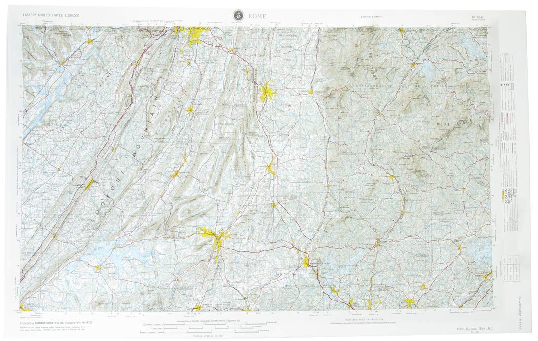
Hubbard Scientific3D Rome NI166 Map | A True Raised Relief Map - You Can Feel the Terrain | Vacuum-formed Molded Map | 33″ x 21″ | Detailed Topography
World Executive, Poster Size, Tubed: Wall Maps World
Relief Map of the Holy Land: Then and Now Wall Chart
Muir Way - California 1977 Shaded Relief Map - Flat 2D Paper Print - Shaded 3D Illusion - Gallery Quality Fine Art Paper & Inks - 100% Cotton & Acid-Free - Made in USA - 24” x 26” 2D Print - No Frame
Rand McNally Signature Edition World Wall Map: Fol
American Educational Products Raised Relief Map 418 Sequoia-Kings Canyon National Park
Swiftmaps World Premier Wall Map Poster Mural 24h x 36w
Hubbard Scientific 3D Chattanooga NI163 Map | A True Raised Relief Map - You Can Feel the Terrain | Vacuum-formed Molded Map | 32″ x 21″ | Detailed Topography
Relief Map of the Middle East: Then and Now Wall C
NOWMAP (AquaShield) Double-Sided World Map Poster - 24h x 36w Large Wall Decor - Waterproof Folded Edition with (Pin Stickers)
Swiftmaps SM WOR PREM EL SM LAM World Premier Wall Map Poster Mural 24h x 36w Laminated
Global Walkabout Scratch Off Map - Deluxe Travel Size World Map Poster - Countries and Facts - Travel Gift
Maps International Scratch the World Travel Map - Scratch Off World Map Poster with Gift Tube - X-Large - 84 x 59 cm - - 50 years + of Map Making
MOVA Globe Relief Map Blue 4.5" with Base, Solar Powered Rotating Globe No Need of Battery or Chord, Unique Gift and Decoration
Maps International Giant World Map - Mega-Map Of The World - 46 x 80 - Full Lamination - 2024 Updated
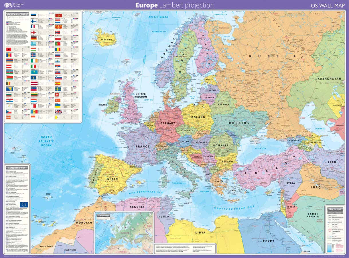
Europe: Lambert projection Map – 12 March 2020
Laminated World Odyssey Map Poster | Executive Style Map | Includes The Most Legible Location Labels | 36" x 24" | Shipped Rolled in a Tube, Not Folded | Great for The Home or Classroom
Atlas & Green Scratch Off World Map Large 70x42cm | Ultra Detailed World Map Poster - All US States. Scratch Map World Accessories Kit Gift Tube. Travel Journal Wall Art - Deluxe Cartographic Map
Restoration Cartographic Italy Minimalist Relief Map, Topographic Wall Art for the Home or Office, Minimalist Series, 12 x 18 Inches
carstyling XXL 3D-Relief map of Germany 75 x 100 mm
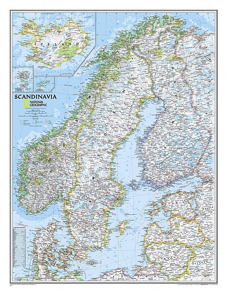
Scandinavia Classic, Tubed: Wall Maps Countries & Regions
England South West relief wall map A4 gift box
KASTWAVE Tapestry World Wall Map Mural, Decoration Vintage World Map Hanging Poster for Kids Student, Art Educational Background Wallpaper Wall Hanging for Living Room Home Office (39.3 x 59'' M)
GoodernWorld Map Poster,Geography Educational Knowledge Chart,50×35cm Wall Art Canvas Printing Classroom Office Bedroom Aesthetic Poster and Decoration for Preschool, Kindergarten,Elementary
Canada Classic, Tubed: Wall Maps Countries & Regions
National Geographic Maps Australia Classic, Tubed: Wall Continents
National Geographic Maps World Classic, Laminated: Wall World Map – Wall Map, 2 August 2012
Luckies of London Scratch off Map World Poster, Detailed Map of the World with capitals, states, cities, Scratch Map Deluxe Edition
Construction of Maps in Relief. Illustrated
Funito Scratch Off Map of The World with Flags - 83 * 60cm Easy to Frame Scratch Off World Map Wall Art Poster with US States & Flags - Deluxe World Map Scratch Off Travel Map Designed for Travelers
ImagimakeMapology World- World Map And Its Countries- Learning Aid & Educational Toy- Jigsaw Puzzle- For kids Age 4 and Above
World Decorator, Laminated: Wall Maps World
24x36 World and USA Classic Premier 3D Two Wall Map Set (Laminated)
VeiVian World Map Tapestry, Map of World Vintage Topography Educational Tapestries Posters for College Kids Student Dorm Wall Art, Geographical Travel Map Tapestry for Bedroom Living Room, 60X40in


![World Map [Folded]](https://m.media-amazon.com/images/I/81ef0jrm6oL.jpg)


